")
About
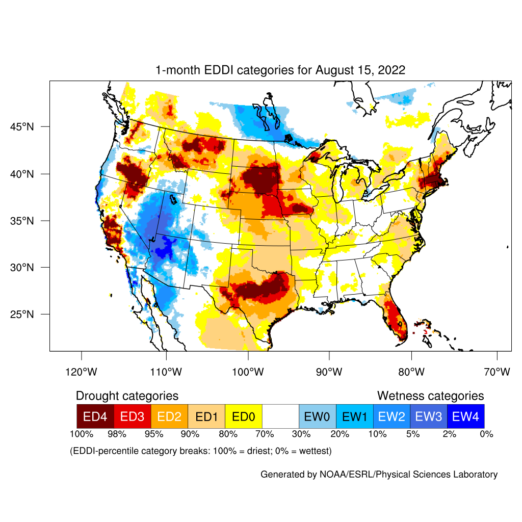
What is EDDI?
The Evaporative Demand Drought Index (EDDI) is an experimental drought monitoring and early warning guidance tool. It examines how anomalous the atmospheric evaporative demand (E0; also known as "the thirst of the atmosphere") is for a given location and across a time period of interest. EDDI is multi-scalar, meaning that this period—or "timescale"—can vary to capture drying dynamics that themselves operate at different timescales; we generate EDDI at 1-week through 12-month timescales.
This webpage offers a frequently updated assessment of current conditions across CONUS, southern parts of Canada, and northern parts of Mexico; a tool to generate historical time series of EDDI for a user-selected region; introductions to the EDDI team; and a list of resources for users to explore EDDI and its applications further.
Why use EDDI?
EDDI can offer early warning of agricultural drought, hydrologic drought, and fire-weather risk by providing near-real-time information on the emergence or persistence of anomalous evaporative demand in a region. A particular strength of EDDI is in capturing the precursor signals of water stress at weekly to monthly timescales, which makes EDDI a strong tool for preparedness for both flash droughts and ongoing droughts.
How often is EDDI updated?
Currently, EDDI is generated daily—though with a 5-day lag-time—by analyzing a near-real-time atmospheric dataset. This lag-time results from the procedures to quality control the meteorological data used to estimate evaporative demand. There is also an ongoing effort to forecast EDDI based on seasonal climate-forecast information.
Acknowledgements
This work is supported in part by grants from (i) NOAA's Joint Technology Transfer Initiative (JTTI) for the project titled "Operationalizing an Evaporative Demand Drought Index (EDDI) service for drought monitoring and early warning;" (ii) NOAA's Sectoral Applications Research Program (SARP): Coping with Drought in Support of the National Integrated Drought Information System (NIDIS) program for the project titled "Developing a wildfire component for the NIDIS California Drought Early Warning System;" (iii) DOI's North Central Climate Science Center for the project (Grant #G14AP00182) titled "Ecological Drought, Climate Extremes and the Water Cycle across Timescales;" and (iv) Western Water Assessment, an NOAA RISA program, for the project titled "Enhancing the usability of EDDI," with funding originating from NIDIS.
Any issues with accessing the plots and other information on this page are welcome and should be sent to ***@noaa.gov.